The polar coordinate system
This is not a math tutorial. See Why am I writing about math?
The Wikipedia Polar coordinate system page seems especially good (accessed on January 19, 2026).
Note: there’s some useful content starting at the heading: Writing complex numbers in the polar form
The polar coordinate system uses distance and angle to indicate where a point is on a 2D plane:
- distance: the point’s distance from the pole
- angle: the point’s direction from the pole, relative to the direction of the polar axis
Polar coordinates are written as as opposed to with the Cartesian system.
Polar coordinates have a pole that acts like the origin in the Cartesian system, and an axis that acts like the x-axis in the Cartesian system. Except the polar axis has a starting point () that is treated like an origin.
- the component of a polar coordinate is the distance from the origin.
- the component of a polar coordinate is the angle from the polar axis
Positive angles are measured counter-clockwise from the polar axis. Negative angles are measured counter clockwise from the polar axis.
Can be negative? My understanding is that is the magnitude and is always positive, but it seems that is a reflection — is from .
Writing complex numbers in the polar form #
The form that seems clearest to me is .
It can also be written without explicit multiplication:
There’s also a shorthand notation where cis stands for “cosine + i sine”:
There is also a form of writing complex numbers using the angle () symbol: means “magnitude r at angle ”.
The exponential form of complex numbers #
I’m ignoring the exponential form for now.
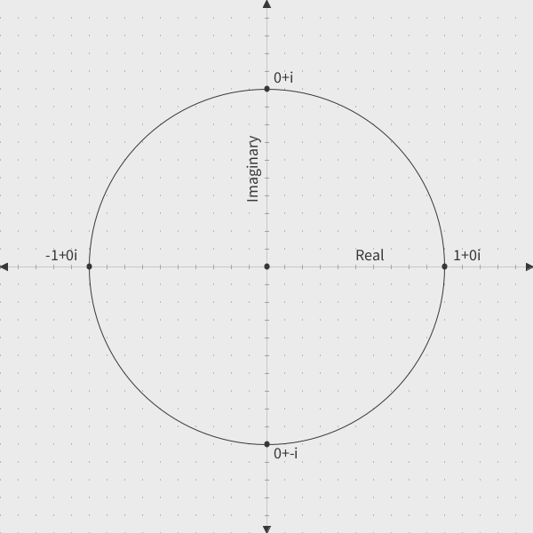
The rectangular form of the powers of i #
It’s useful to look at a plot of the powers of in the rectangular form to see how the angles for the polar form are derived
The powers of in the rectangular form:
- i^3 = 0 + -i$
The powers of i in the polar form #
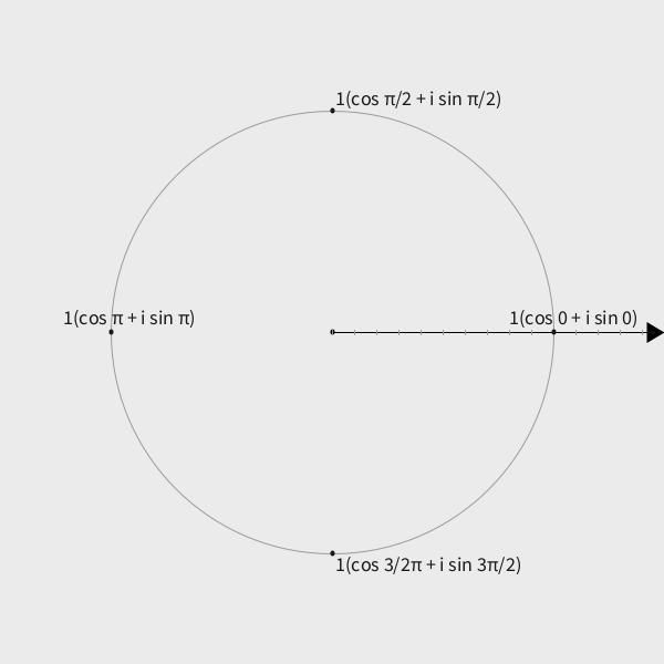
Where do the angles for the powers of i come from? #
Looking at the rectangular complex plane, it’s obvious that the angles can be calculated using the rules of trigonometry based on the real and imaginary components of the powers of . But I think a better answer is that the angles are what they are by definition:
is defined as the square root of : . This creates a system that has certain characteristics:
- start with algebra: We want
- rectangular form: We define , so it plots at (0, 1)
- convert to polar: the point (0, 1) is at distance 1, angle
So the angle [comes from the] requirement that:
- is purely imaginary (real part = 0)
- has a magnitude 1 (on the unit circle)
- (the defining property) 1
This explains why makes sense in terms of geometry. See notes / Multiplying complex numbers
References #
Wikipedia contributors. “Polar coordinate system.” Accessed on: January 19, 2026. https://en.wikipedia.org/wiki/Polar_coordinate_system#Complex_numbers .
Professor Leonard. “Introduction to Polar Coordinates (Precalculus - Trigonometry 36).” Nov 18, 2021. https://www.youtube.com/watch?v=Ol_a6LEdo3M .
-
Claude. ↩︎